Sie haben keine Artikel im Warenkorb.
Yachtelektronik
-

Regulärer Preis: 252,50 €
227,95 €
-
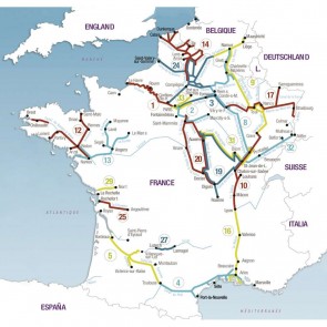
Plastimo navigatiekaart 3 The Marne – from Paris to Vitry – Le-François
Each canal, river or navigable waterway is presented in the form of a cartographic atlas which includes, on each page, a portion of the route, accompanied by a text giving useful information on navigation, moorings, supplies and tourism. A technical description gives the characteristics of the waterway as well as advice on the best way to use the canals and locks.
Full-colour guides, at 1/25.000 or 1/50 000 scale, size 165 x 315 mm, range from 72 to 170 pages. Each guide features technical and touristic pictures. Texts are in English, French and German.
Mehr erfahrenRegulärer Preis: 35,50 €
31,95 €
-

Plastimo navigatiekaart 8 Champagne-Ardenne - from Namur to St-Jean-de-Losne
Each canal, river or navigable waterway is presented in the form of a cartographic atlas which includes, on each page, a portion of the route, accompanied by a text giving useful information on navigation, moorings, supplies and tourism. A technical description gives the characteristics of the waterway as well as advice on the best way to use the canals and locks.
Full-colour guides, at 1/25.000 or 1/50 000 scale, size 165 x 315 mm, range from 72 to 170 pages. Each guide features technical and touristic pictures. Texts are in English, French and German.
Mehr erfahrenRegulärer Preis: 30,50 €
27,95 €
-

Plastimo navigatiekaart 24 Picardy – rivers and waterways
Each canal, river or navigable waterway is presented in the form of a cartographic atlas which includes, on each page, a portion of the route, accompanied by a text giving useful information on navigation, moorings, supplies and tourism. A technical description gives the characteristics of the waterway as well as advice on the best way to use the canals and locks.
Full-colour guides, at 1/25.000 or 1/50 000 scale, size 165 x 315 mm, range from 72 to 170 pages. Each guide features technical and touristic pictures. Texts are in English, French and German.
Mehr erfahrenRegulärer Preis: 40,75 €
36,95 €
-

Plastimo navigatiekaart 9 Meuse, Sambre belge, East canal
Each canal, river or navigable waterway is presented in the form of a cartographic atlas which includes, on each page, a portion of the route, accompanied by a text giving useful information on navigation, moorings, supplies and tourism. A technical description gives the characteristics of the waterway as well as advice on the best way to use the canals and locks.
Full-colour guides, at 1/25.000 or 1/50 000 scale, size 165 x 315 mm, range from 72 to 170 pages. Each guide features technical and touristic pictures. Texts are in English, French and German.
Mehr erfahrenRegulärer Preis: 40,75 €
36,95 €
-
 65,95 €
 -
 49,25 €
 -
 39,40 €
 -
 45,50 €
 -
 56,95 €
 -
 35,80 €
 -
 42,60 €
 -
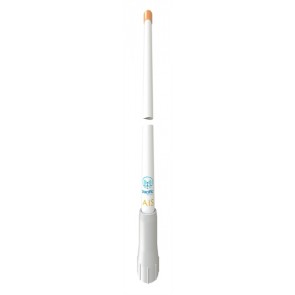
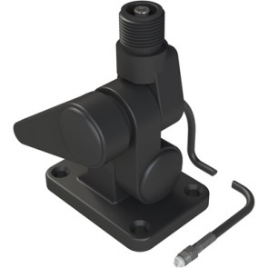
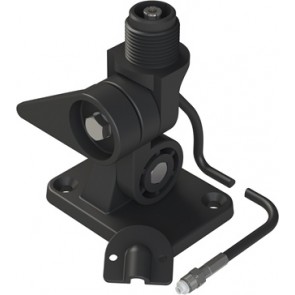
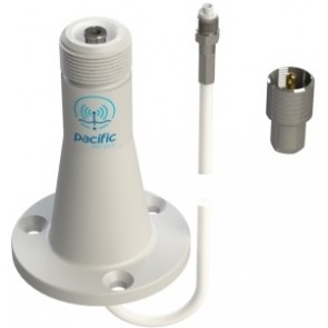
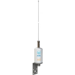
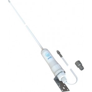
Pacific Aerials SeaMaster - P6111 VHF+AIS kantelvoet+5m kabel
Pro kantelsteun met een ingebouwde connector, kabel met FME connector. Optionele verlengkabels verkrijgbaar. Mehr erfahrenRegulärer Preis: 51,95 €
49,95 €
-
 82,20 €
 -
 55,35 €
 -
 55,50 €
 -
 62,50 €
 -
 88,50 €
 -
 58,95 €
 -
 50,15 €